Recently, Professor Jiang Aiwu's team from the College of Forestry at our university has made new progress in bird species distribution modeling research. The related findings, titled "Incorporating landscape context into species distribution models improves predictions for migratory shorebirds," were published in Communications Earth & Environment, a journal under Nature. Wen Ke, a doctoral student in ecology at the College of Forestry of Guangxi University, is the first author of the paper, Jiang Aiwu is the corresponding author, and Guangxi University is the sole affiliated institution of the paper.
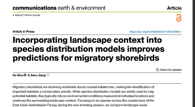
Migratory shorebirds depend on coastal wetlands for foraging and resting: they forage on tidal flats at low tide and move to nearby suitable sites to rest after the tide comes in, so the value of a wetland is closely related to its surrounding environment. Coastal wetlands in the East Asian-Australasian Flyway (EAAF) are facing severe loss and degradation, and shorebird populations continue to decline, making the accurate identification of potential habitats an urgent need for conservation. However, existing species distribution models mostly focus on the environmental conditions of a single site and rarely consider the composition and distribution of surrounding wetlands, making it difficult to fully reflect shorebirds' need to use multiple habitats.
To address this issue, the research team focused on the non-breeding season distributions of six shorebird species along the EAAF coast, integrated distribution records from the citizen science platform eBird with remote sensing environmental data, and constructed a Nested Species Distribution Model (N-SDM) that accounts for both large-scale climatic conditions and local habitat characteristics. On the basis of conventional pixel-scale environmental variables, the study further introduced landscape indicators such as the proportion of surrounding habitat area, patch density, and land cover diversity. The results showed that after adding landscape information, habitat prediction accuracy improved for most species, indicating that incorporating the surrounding environment helps the model more comprehensively reflect the habitat needs of different shorebirds. Based on this model, relative habitat suitability maps for the six shorebird species covering the EAAF coast were generated, providing more refined spatial information for identifying potentially suitable areas for migratory birds and for territorial spatial planning.
The related research was funded by the Guangxi Science and Technology Base and Talent Special Project and the Guangxi Graduate Education Innovation Program Funding Project.
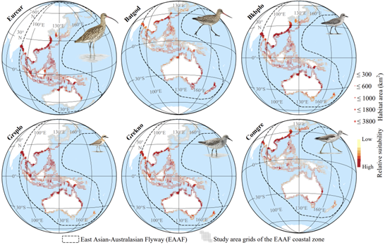
Fig. 2 Potential habitat distribution of six shorebird species along the coast of the East Asian-Australasian Flyway (EAAF)

 Address: No.100,East Daxue Road,Xixiangtang District,Nanning, Guangxi,China
 Postal Code: 530004
 Tel: 86-771-3238863
 Email: gjc@gxu.edu.cn
